- AuthorPosts
- September 23, 2023 at 20:16 #54867
 giogioParticipant
Hi!
I noticed that many times the highway=path (Hiking path) that have NO tag trail_visibility are rendered as the trail visibility excellent
It wouldn’t be better that the higway will be rendered as trail visibility=no if this data is not present?
I noticed many times that people miss to put this info as also the Sac_scale…
For example the alpine route that go to Grandes Jorasses
https://www.openstreetmap.org/edit#map=19/45.86847/6.98871
where the trail visibility is missing .
ThanksSeptember 23, 2023 at 20:30 #54868 TobiasKeymaster
Hi Giogio,
that depends on the theme… in Elevate paths with missing trail_visibility have a separate rendering: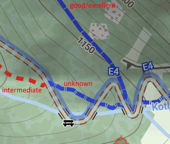
Best regards,
TobiasDeveloper of Elevate mapstyle
September 23, 2023 at 22:03 #54870giogioParticipantHi Tobias!
Yes of course it depends of the theme… I never noticed this difference… thanks for letting me know!
I also have checked the elevate map key https://www.openandromaps.org/en/legend/elevate-mountain-hike-theme but didn’t found this.
Isn’t better that without information is like no visibility ? I always thougt that these trails are with excellent visibility because they are very similar
So in the meantime I’ve modified your very good theme and copied the data below
<rule e=”way” k=”trail_visibility” v=”bad|horrible|no”>
under
<rule e=”way” k=”trail_visibility” v=”~”>
And IMHO it looks better for me.Thank you
September 24, 2023 at 17:46 #54878TobiasKeymasterI also have checked the elevate map key https://www.openandromaps.org/en/legend/elevate-mountain-hike-theme but didn’t found this.
It’s under “Hiking paths” in the first example:
“Yellow – Hiking: flat or slighty sloped, no fall hazard, SAC T1;
in the example without information about trail visibility (if this information is missing is only shown on paths with difficulty information): long dash, short dash, short spaces”Isn’t better that without information is like no visibility ?
I don’t think so; in Elevate I usually have a separate rendering if a tag is missing; e.g. also for sac_scale. Because it might be missleading to assume a value (here: “I don’t want to use a path with bad visibility, so I won’t check this path” – while it might be perfectly visible), and also mappers might want to fix a missing tag.
I used to show excellent visibility with no dashes at all, but I didn’t like that – so maybe I changed it too similar to “no trail visibility info”. I’ll look if I can render them more distinct.Developer of Elevate mapstyle
September 24, 2023 at 19:13 #54879giogioParticipantIt’s under “Hiking paths” in the first example:
“Yellow – Hiking: flat or slighty sloped, no fall hazard, SAC T1;
in the example without information about trail visibility (if this information is missing is only shown on paths with difficulty information): long dash, short dash, short spaces”Oh sorry I missed it
I don’t think so; in Elevate I usually have a separate rendering if a tag is missing; e.g. also for sac_scale. Because it might be missleading to assume a value (here: “I don’t want to use a path with bad visibility, so I won’t check this path” – while it might be perfectly visible), and also mappers might want to fix a missing tag.
I used to show excellent visibility with no dashes at all, but I didn’t like that – so maybe I changed it too similar to “no trail visibility info”. I’ll look if I can render them more distinct.Thank you!
Isn’t possible to made them like for example the image attached to made them more clear?September 24, 2023 at 19:33 #54882TobiasKeymasterIsn’t possible to made them like for example the image attached to made them more clear?
That’s what I meant with “I’ll look if I can render them more distinct.”
Developer of Elevate mapstyle
September 24, 2023 at 19:39 #54883giogioParticipantThat’s what I meant with “I’ll look if I can render them more distinct.”
👍 thank you
1 user thanked author for this post.
September 27, 2023 at 22:19 #54890TobiasKeymasterAs I had to do a little bugfix I also added a more distinct rendering for sac_scale paths without trail_visibility – still the same pattern, but not as tiny spaces.
Developer of Elevate mapstyle
September 28, 2023 at 20:04 #54893giogioParticipantHi Tobias!
Thank you, now is more clear for me!
I’ve another question, I would like that trail with sac_scale T4 have a different colour from T5-T6, don’t you think is a good idea?
Becouse T4 routes are not tricky as T5-T6 in my opinion..
I know that they are rendered slighlty different dashed or long spaces, but if they have also a different colour will be more clear in my opinion.(Maybe a grey colour? Or a colour like #330033 for example)
Thank youSeptember 29, 2023 at 21:48 #54896TobiasKeymasterHi Giogio,
great that it works for you.
sac_scale colors in Elevate are derived from the difficulty of hiking trails in the Bavarian Alps (which is also similar to ski pistes). This scale is not exactly the same as sac_scale, but relatively similar:
https://www.alpenverein.de/artikel/schwierigkeitsgrade-von-bergwegen_8de95a6d-b490-4963-86cf-a0907c48a331
Everything T4 and higher would be black (as it is blue in Switzerland). That’s why I used it like this in Elevate. I don’t want use different colors, that’s why still black with slight differences.
Best regards,
TobiasDeveloper of Elevate mapstyle
September 30, 2023 at 00:07 #54897giogioParticipantHi Tobias
Ok I understand no problem, it was only a hint from my side 🙂Thank you for your work!
1 user thanked author for this post.
October 15, 2023 at 18:46 #54940Viajero Perdido
ParticipantHi. I hope this is a suitable thread; I noticed a possible bug that might be related to the above.
I downloaded the latest Elevate from here, and the latest (June ’23) LoMap for South Korea. I’m using the current Locus 4, gold. I’m noticing a few ways that disappear from the map. The ways are tagged foot=designated, highway=path, sac_scale=mountain_hiking (eg 815171694), and they are unexpectedly not rendered only with the combination of [Elevate && Hiking && LoMap].
There’s no urgency as far as I’m concerned; I can just switch to OAM. Thanks. BTW, I just discovered how well Elevate works in City mode, showing metro stations clearly which can be important.
October 15, 2023 at 20:42 #54941TobiasKeymasterI downloaded the latest Elevate from here, and the latest (June ’23) LoMap for South Korea. I’m using the current Locus 4, gold. I’m noticing a few ways that disappear from the map.
Elevate is made for OpenAndroMaps. So if it’s working with OAM, but no a LoMap, this is not a bug, but an incompatibility. Probably some data/tag Elevate needs for rendering isn’t available in the LoMap.
Developer of Elevate mapstyle
October 15, 2023 at 20:57 #54942Participant(Ah fark, I lost my text due to a spammer block, go back, gone.)
I thought you’d done some work (appreciated!) to make Elevate compatible with LoMaps, hence this possible bug report. The data must be available in the map, because if I switch from Hiking (all items ticked) to any of the other 3 modes, the trail appears. But maybe it’s in an incompatible form, I don’t know.
But since I generally use OAM, it works great, so I’m happy. Cheers.
October 15, 2023 at 21:14 #54944TobiasKeymasterHiking map style in Elevate needs some tags to be rendered that are probably not available LoMaps. Hiking path rendering is pretty complex in Elevate, so I’m not surprised if there are issues with other maps.
Developer of Elevate mapstyle
1 user thanked author for this post.
- AuthorPosts
- You must be logged in to reply to this topic.