


The already announced new map generation is now ready to be released for download.
With this new generation, fundamental design weaknesses such as common hike/cycle route names or fragmentation of MTB routes in some cases have been resolved.
The new features meant a deep impact on the production structure of the maps.
New hardware on which the new V5 Mapsforge Writer from EMUX runs smoothly and a complete rewrite of most software was necessary.
Here are the new features in a nutshell:
- The MTB routes are now rendered independently and according to categories (like the cycle routes) – this means that interregional MTB routes such as in the UK or the Granittrail in the Waldviertel are prominently highlighted.
- Overlaps between bike and MTB routes are now neatly resolved.
- Short names of MTB/bike/hike routes are now separated
- The links between route nodes (NL) are now rendered later on
- Dozens of OSMC hiking symbols are added….
What needs to be done on your side: An update to the render theme – when installed directly on Android in Locus, the theme is installed/updated automatically.
Thank you for your feedback during the beta test, where a profound bug was discovered and fixed.
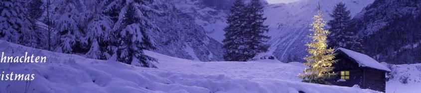
Have a peaceful Christmas,
We wish you good health and beautiful walks in the winter-snow
The team of OpenAndroMaps
Tobias, Michael, Christian
Unfortunately, the cloud server has completely crashed, and restoring the existing backups did not help either.
I have now moved the website to a normal web space and will try to get the whole thing up and running again tomorrow.
At the moment, there will probably be problems with the redirects – this mainly concerns the direct install on Android.
This will also be taken care of tomorrow in the course of the day.
Sorry for the trouble.
PS: The registrations and forum posts of the last 24h are unfortunately also lost, sorry.
Many thanks to all the donors who
made the new equipment possible
The new rendermachine is running since this morning and is currently being fed with the latest Planet-File. The aim is to put new maps under the Christmas tree for our community. At the same time, these maps are being completely renovated.
Test maps and a beta version of the new Elevate redertheme are available here:
Whats new, in a nutshell:
- The MTB routes are now rendered independently and by category (like the cycle routes) – this means that supra-regional MTB routes such as in the UK or the Granittrail in the Waldviertel are highlighted prominently.
- Overlaps between bike and MTB routes are now neatly resolved
- Short names of MTB/bike/hike routes are now separated, this is only now possible with the fast rendermachine and Mapsforge V5
- The connections between route nodes (NL) are now rendered later at higher zoom levels for better overview
- Dozens of OSMC hiking symbols are added
- etc..
Many people might ask themselves: “Why Excel for an OSM map project?
Well, with OAM there is a stock of around 270 maps to manage with the most diverse settings.
For example, map symbols for petrol stations and drinking water sources in urban areas appear only at much higher zoom levels than in Scandinavia – for this, there is also the ELEMENTS theme by Tobias, which takes this into account. This means that different tag mappings have to be created and assigned to individual maps.
But also such trivial things as map centres, languages, fineness of elevation data, allocation to render queues (load balancing) have to be managed. Corresponding start-up programmes for each individual production step such as conversion of file formats, creation of boundary polys, elevation data, sea areas, inheritance of bike/MTB/hike routes etc,etc. – belong to !automated! production.
Last but not least, the web pages must be regenerated after each update.
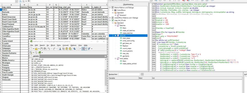
This is impossible to do manually, so far Excel-VBA programmes in combination with PERL scripts have done most of the hard work.
For about 10 days now, I have been sitting in front of the computer every free minute and porting VBA to Starbasic. Porting means cleaning up 9 years of organically grown programmes and simply rewriting them, leaving out my beloved PERL for pure administration jobs.
In addition, a flexible folder structure was implemented to allow porting to other machines and effective load balancing/caching.
With the switch to a free office package and the cleaning up of the programmes, it is now much easier for my co-authors to familiarise themselves with map production in OpenAndroMaps.
The first maps rolled out today from the LibreCalc generated start scripts, the automated creation of the download pages will be addressed next week.
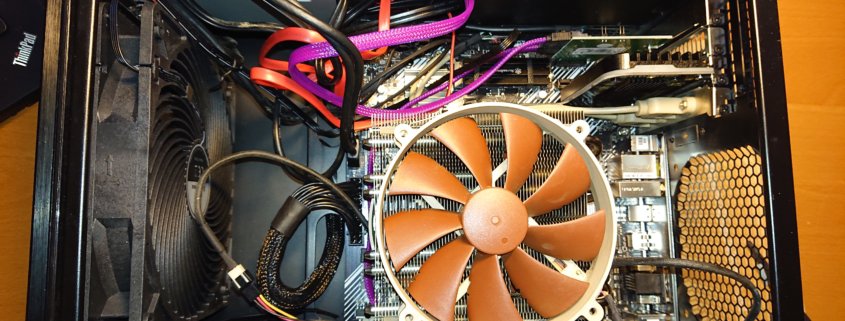
New rendering machine: Thank you very much for your donations – most of the parts for the PC have arrived and are awaiting assembly, which will be started after the next map update if there are no unexpected problems with the software port.
For me this is a great reassurance as it means that the test computer will go to @Michael and thus 10 years of accumulated knowledge about vector maps will be preserved.
There will be more detailed information about the new render machine.
Here in a nutshell: AMD Ryzen 5600G, 128GB RAM, ASUS MB, 2TB 970evo Plus as standard drive, 1TB Toshiba SSD for the planet extracts and height data, NOCTUA fans, new semi-passive power supply, as well as various used parts from the spare and new fans for the old case.
Should my time run out, this computer will also go to @Michael.
best wishes and stay healthy
Christian