Multilingual maps- what does this mean?

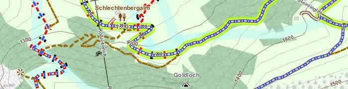
As an example: The OpenStreetMap database provides NAMES for most objects like Citys, Roads, Churches, Rivers, aso.. in different languages. So for the map of Israel usually in hebrew, arabian, english, maybe in german. For maps of Russia usually in russian and english.

Up to now only one language per maps was possible to include and display on our smartphones.
So providing two languages for one maps for OAM meant making –  and for you, downloading two different maps.

With the new, multilingual maps it is possible to include different languages while making the map and switching map-language in an APP – if an APP is compatible with these maps AND provides a language switcher. This is the case for ORUXMAPS and LOCUS for Android and Cruiser for Android + PC.

Here you see a small screencast of ORUXMAPS switching between russian and englich using the map of Moscow:

Orux-Multilingual_Maps_OAM[EN]

So we decided to provide the multilingual maps on OpenAndroMaps.
The effort for providing two different versions of the maps (old single and new multilingual = 250 each) is crazy.
However, we are aware that a lot of APPs still only support the old “V3” single-language maps – and keeping our users in mind we will support both versions for while, as far and long as our resources will allow this.

For now we provide the new multilingual “V4” maps for download to PC AND for direct install to ORUXMAPS. The download/install buttons for these maps are RED, the included languages are shown for each map as abbreviations in square brackets. The new map files itself are identified by a “_ML” suffix.
So, eg., while the name of old map is “Germany.map” the name of the multilingual map is “Germany_ML.map”

For more information klick here

The old maps that we provided in different languages will be available in future only in one language (usually native lang. or english) – this is the case for all russian mapps, several maps for Asia aso. PLUS the multilingual version.

The POI files for the multilingual maps are included in the zip-files of the maps. With the next update of ORUXMAPS these POI-files will be installed in the right place on your Smartphone if chose direct install.


Next posting will deal with the complete redesign of the categorie-structure of the OpenAndroMaps POI-files.

Best regards
Tobias & Christian

Dear OpenAndroMaps Community!


Unitl now the map starting position after loading a new map was set to the arithmetical center of the area the map covered.
Unfortunatelly sometimes, at high zoom levels and with GPs device disabled, you ended up in the blue sea or in the middle of nowhere after loading a map.

From now on every map has its own starting position set by hand – usually the capital of the country/region or a well known natural preserve or something like this.

As an example: Loading a fresh map of Cannary Islands – until know you ended up in the blue sea, from now on the map starting point will be N28,46560°  W16,25398° = Santa Cruz de Tenerife.

This improvement is the reason why the update for March is delayed for a few days – the map starting points for ~270 maps have to be defined. The updated maps should be available from 7th of March on starting with Europe/Germany.


best regards
Tobias & Christian

Most of the hiking symbols tagged in OpenAndroMaps are now included in the OpenAndroMaps.
Redering of these symbols follow the rules of  Waymarkedtrails .

Important: If more than one route is assigned to a way : The waymark for the route with the highest priority is rendered = iwn, nwn, rwn, lwn.

Please download the latest maps and the latest version of the Elevate rendertheme and activate the rendering of the hiking symbols in your APP.
in the Elevate theme the background symbols appear at zoom-level 13, the whole symbols (background,foreground,text) appear at zoom-level 15.

Further details and rules for osmc:symbols at OpenAndroMaps can be found here

Austria and South Tyrol has finished the LIDAR Laserscans and released this dataset to the public for free.
@Sonny converted it to usual hgt files and published it for download:

http://data.opendataportal.at/dataset/dtm-austria
http://data.opendataportal.at/dataset/dtm-german
http://data.opendataportal.at/dataset/dtm-slovenia
http://data.opendataportal.at/dataset/dtm-spain

For the OpenAndroMaps this means that serveral Maps benefit from these new elevation data, and believe me – the difference is incredible.

  • Austria
  • Alps (Austria und South Tyrol)
  • Alps_Ost
  • Italy (South Tyrol)
  • Berlin, RheinlandPfalz
  • Slovenia
  • Spain

I strongly recommend you to update these maps, especially if you are a mountain hikers or MTB enthusiast.

Here in this Thread you can see examples of various tiles [DE]


After an extended testing period Elevate 4 has been released today. The map key was also updated.

Downloads as alway on the Elevate page.

Major changes:

  • One size only: SVG version which scales with screen density is now default, no more different sizes.
  • All graphics are scaleable: all symbols and patterns are now displayed with scalable vector graphics and scale with screen density, instead of pixel based PNG files. For example patterns like those on private roads are now scaled and should be better visible on high density screens.
  • Routes: national and international routes have seperate colors (same for hiking and cycling, blue and red, so I had to change regional cycling routes as well), hiking routes colors match now those that are used for hiking routes in some areas. General route rendering has been optimized as well.
  • Mountain Bike: seperate MTB map style with rendering of visibility of paths and with new rendering for mtb_scale_uphill
  • Locus: Locus version includes now Locus Edition (LE) versions for single language V3 maps and standard Elevate for multilangual V4 maps. All objects scale now much better in Locus LE.
  • Access limits: those are filtered now, a way with only private/no access is only rendered as that in hiking (or cycling) mapstyle, if this access limit is also valid for pedestrians (or cyclers). Only the city mapstyle shows general access limits.
  • And many more smaller additions and optimizations.
Elevate 4

The new MTB map style of Elevate 4

New general maps on OpenAndroMaps

Michael Bechtold did an incredible job producing these maps. For each zoom level he used different an multiple sources ensuring best usability by providing a reasonable filesize. Best is that he aggreed to share these maps for free with our community on OpenAndroMaps.

These maps are pixelmaps in sqlite data format plus a special version for Oruxmaps. Pixelmaps are the best choice for general maps cause they load much faster at low zoom levels compared to vectormaps while vectomaps are providing much more detail at high zoom levels for a fraction of the filesize.

The pure sqlite-maps (for Locus and all APPs capable to handle sqlite) are not compressed so you don’t need additional space and time for decompressing while quick-installation on your device.

As announced earlier the renderthemes made and maintained by Tobias

  • Elevate (for urban areas)
  • Elements (for wider areas)

are now the default ones for the OpenAndroMaps hike and cycle vectormaps and included in the map-downloads.

The andromaps_## renderthemes are no longer maintained.
However, these themes are still provided for download and quick installation:

Andromaps hike and cycle themes
Andromaps MTB-Theme

Best regards
Christian

The Andromaps map styles won’t be updated as Christian already mentioned, and I want to add bit to that.

With the Release of OruxMaps 6.5.0 in the Google Playstore the long beta phase is finished and now the most common version supports Elevate 3. ist die lange Betaphase beendet und somit unterstützt auch die gängigste Version Elevate 3. If someone still uses Elevate 2 with the latest version of OruxMaps I can only advise to update.

Together with the adapted version for Locus the two most important apps are now running well with Elevat 3, as many others.

Therefore Elevate 2 will only get the most important updates from now on and at some point won’t be updated at all. The posibilities of Elevate 2 are pretty exhausted anyway. Elevate 2 will be kept available as well as the Andromaps map styles.

The recommended and regularly updated map style is Elevate 3. Accordingly I adjusted the map key and thinned it out a bit.

Low zoom areas are now much more usable: names for states and mountain ranges/areas are displayed, names of lakes/glaciers/woods/mountain ranges/protected for larger areas are displayed earlier and for smaller areas later (differs for city style)

Especially in wide areas like in the North, Africa, Canada, South America these improvements offer a much better overview for route planing. For these areas please use the Elements – Theme from Tobias.

For urban areas and central Europe the Elevate Theme from Tobias is probably the best choice.

Please download (or use direct install) for the latest Elevate Theme – it includes a lot of additional improvements:
https://www.openandromaps.org/en/legend/elevate-mountain-hike-theme

  • An old Bug in Mapsforge forced us to transform access=no to access=acc_no. This means that have to update your Themes, if you would like to have access restrictions rendered in the maps
  • There are new features in the Maps and Themes like kissing_gates and turnstiles
  • Especially for users of the New Zealand map we modified the rendering of water multipolygons (lake, riverbank, reservoir, aso). Up to now wrong tagged multipolys resulted in flooded areas along lakes and rivers. This issue occours in almost every MP in New Zealand caused by the automated LINZ import of Goverment data. As said, this should be resolved with the updated maps/themes

We strongly recommend to update the themes by using the Quick-Installation:
For Elevate/Elements Themes of Tobias:
https://www.openandromaps.org/en/legend/elevate-mountain-hike-theme
For the andromaps_## themes:
https://www.openandromaps.org/en/legend/andromaps_hc_en

A Theme in OS-Landranger style can be found here – (c) John Percy:
https://www.openandromaps.org/en/oam-forums/topic/voluntary-uk

The new maps will be finally available with the updated maps of Europe and Germany on 11/12th of August.2015

We wish you a pleasant summer,
Tobias & Christian