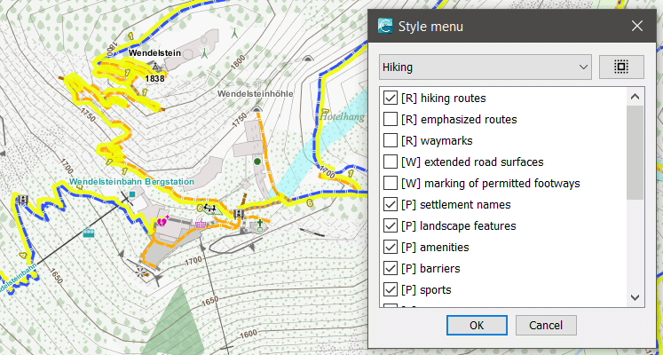
 With the new Elevate 4.5, there are lots of changes to the displayed POI symbols and captions. There are now more colors which depend on categories that are identical to the POI options. The categories have been resorted and all symbols have a more unified look. Also the mapstyle options now have category letters (R=Route, W=Ways, P=POIs, A=Areas). That all those changed symbols can be displayed at all I’ve renamed the symbol folder from ele_res to ele-res – the old one can be safely deleted.
You can download it here: https://www.openandromaps.org/kartenlegende/elevation-hike-theme